
Getting your audio player ready…
Revolutionary research reveals the most comprehensive digital atlas of Roman roads ever created, dramatically expanding our understanding of the Empire’s vast infrastructure. The new dataset, named Itiner-e, increases the known road network by over 100,000 kilometers and provides unprecedented detail about transportation routes that connected millions across three continents, now available for anyone to explore online.
At its zenith in the second century AD, the Roman Empire encompassed more than 55 million inhabitants stretching from Britain to Egypt and Syria. While historians have long recognized that an extensive network of roads facilitated the Empire’s development and maintenance, previous digitizations remained incomplete and lacked the resolution needed for detailed study. The new research, led by Tom Brughmans from Aarhus University, Pau de Soto from Universitat Autònoma de Barcelona, and Adam Pažout, and published in Nature Scientific Data, addresses these limitations through meticulous compilation of archaeological and historical evidence combined with satellite imagery and topographic mapping.
Revolutionary Dataset Transforms Understanding of Imperial Infrastructure
The Itiner-e project represents years of collaborative work that emerged from what Brughmans describes as “enormous frustration” with the state of Roman road data.
“It’s like the most enigmatic topic in Roman archaeology,” he told New Scientist. “We even have proverbs that say, ‘All roads lead to Rome.’ So why on Earth can’t I download all the Roman roads? Where are they?”
This fundamental question drove the team to create what they call the first open dataset of its kind, combining archaeological records, topographic maps, and satellite imagery to produce the most detailed openly accessible digitization of the Empire’s road system.
According to the research published in Scientific Data, the dataset encompasses 299,171 kilometers of roads – a substantial increase from the previous estimate of 188,555 kilometers provided by the Barrington Atlas of the Greek and Roman World. This nearly 60 per cent expansion in documented road coverage represents not merely the discovery of new routes, but a fundamental reassessment of how Roman engineering adapted to geographical realities across the vast imperial territory. The researchers gave each stretch of road a confidence rating based on the quality of the source, revealing crucial gaps in current knowledge.

The Roman road network as mapped by the Itiner-e project, showing the vast extent of infrastructure connecting the ancient empire. (Itiner-e)
Debunking Myths About Roman Roads
The research team attributes this dramatic increase to several factors, including enhanced coverage of roads in the Iberian Peninsula, Greece, and North Africa. But critically, they also adapted previously proposed road routes to fit geographical realities. Although Roman roads are famous for being straight, Catherine Fletcher at Manchester Metropolitan University, who wasn’t involved in the study, notes that this is actually a myth.
“Straight wasn’t always cheap or practical, especially through mountainous terrain,” she explained to New Scientist. “Often, where there was a pre-existing route in place, the Romans would adapt it rather than build anew.”
This methodological shift proved particularly important in mountainous regions, where the team documented winding paths that followed natural terrain rather than forcing straight-line connections between settlements. By allowing roads crossing mountains to follow realistic passes and valleys, the dataset more accurately reflects how Romans actually moved through their empire. The digital atlas now reveals 14,769 distinct road sections spanning almost four million square kilometers, with each segment uniquely citable through a URI (Uniform Resource Identifier) that links to nearby ancient places in the Pleiades gazetteer of ancient places.

Screenshot of Itiner-e.org, a linked open data gazetteer for managing, querying, editing and expanding data about ancient roads. (Brughmans et al/ Nature Scientific Data)
Revealing the Gaps in Ancient Knowledge
Itiner-e comprises 103,478 kilometers (34.6%) classified as main roads and 195,693 kilometers (65.4%) as secondary roads. The main roads – those documented via milestones or historical sources like the Antonine Itinerary and Tabula Peutingeriana – formed the core of the Roman administrative system. These major arteries connected provincial capitals and military installations, facilitating the movement of armies, officials, and information across the empire. The researchers note this number is unlikely to increase significantly, since these were the most documented and studied Roman roads.
Perhaps most revelatory is what the dataset discloses about current knowledge gaps. The authors report that the precise locations of only 2.7% of the roads are known with certainty, while 89.8% are less precisely known based on historical sources and topographic analysis, and 7.4% remain hypothesized. This honest assessment of data quality distinguishes Itiner-e from previous mapping efforts and establishes a foundation for ongoing refinement. For Brughmans, this reflects how difficult it can be to secure funding to excavate entire Roman roads, meaning much work simply hasn’t been done. Major roads have also been built over many times throughout history, making it difficult to uncover the original path.

Comparison of DARMC (in orange) and Itiner-e (in black) datasets, showing an example from France of a region with increased coverage of roads. Brughmans et al/ Nature Scientific Data)
Future Research Horizons and Historical Impact
The openly accessible dataset available at itiner-e.org represents a collaborative effort drawing on contributions from archaeologists, historians, and geographers across multiple institutions. The work was performed between 2020 and 2024, with the MINERVA project leading digitization in North Africa, the Near East, Asia Minor, and Southeastern Europe, while the Viator-e project focused on the Western Roman Empire. By making the data freely available in linked open data format, the research team enables scholars worldwide to build upon their work, correct errors, and add newly discovered routes as excavations continue.
Improved knowledge of the Roman road network can potentially transform understanding of highly impactful events in European history. “The emergence of early Christianity, mass migration and continent-wide pandemics are all phenomena that were influenced by the Roman road system,” says Brughmans. The dataset could prove invaluable for investigating numerous aspects of Roman society, from connectivity patterns between regions that enabled administration of far-flung provinces, to migration routes that spread Roman culture and technology, to disease transmission pathways that periodically devastated Roman cities.
Despite their monumental importance to the empire’s success, Fletcher notes that roads often get overlooked because they aren’t as glamorous as amphitheaters and gladiators. She references the famous Monty Python sketch:
“They’re talking about what the Romans did for us, and they go, ‘And the roads!’ ‘Well, obviously the roads! The roads go without saying.'”
Yet it was precisely these roads – many still visible today or lying beneath modern highways – that made Roman civilization possible, connecting 55 million people across an area stretching from Hadrian’s Wall to the deserts of North Africa.
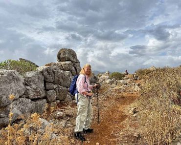
Top image: Roman roads winding through mountain passes leading to Delphi in ancient Greece Source: Itiner-e/New Scientist
By Gary Manners
References
Brughmans, T., de Soto, P., Pažout, A., et al. 2025. Itiner-e: A high-resolution dataset of roads of the Roman Empire. Nature Scientific Data. Available at: https://www.nature.com/articles/s41597-025-06140-z
Itiner-e Project. 2025. Itiner-e: The Digital Atlas of Ancient Roads. Available at: https://itiner-e.org/
Leslie, Tom, 2025. Digital map lets you explore the Roman Empire’s vast road network. New Scientist. Available at: https://www.newscientist.com/article/2503325-digital-map-lets-you-explore-the-roman-empires-vast-road-network/