
A new digital, interactive map reveals the vast road network that spanned much of the Roman Empire, connecting with older routes in Ancient Greece and profoundly shaping the region’s development.
This massive network of roads was among the Roman Empire’s greatest achievements, linking territories from Britain to North Africa and from Spain to the Near East. It enabled people, armies, goods, and ideas to move swiftly and safely across immense distances.
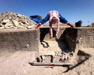
The scientific study Itiner-e: A High-Resolution Dataset of Roads of the Roman Empire was created by identifying roads from archaeological and historical sources, locating them through modern and historical topographic maps and remote sensing, and digitizing them with detailed metadata and specified categories for each road segment. The project draws on published historical and archaeological data, topographic maps, and remote sensing evidence, covering routes dated up to around 400 AD.
The resulting map documents a total of 299,171.31 kilometers (185,196 mi.) of roads across nearly 4,000,000 square kilometers (1,544,408 sq. mi.). The dataset includes 14,769 road segments and is divided into fourteen connected components, representing contiguous landmasses such as continental Europe, Britain, Asia–North Africa, and several Mediterranean islands. At the core of this extensive transport network were the main Roman roads, identified through milestones and historical records.
Roman road network geographical research scope and chronology

The geographical scope of the data collection is broadly defined by the extent of the Roman Empire during the Antonine dynasty, around 150 AD, when the empire reached its peak vastness, encompassing about 55 million inhabitants. The road system on the left bank of the Euphrates, between Samosata and Edessa (modern-day Samsat and Şanlıurfa, Turkey), is included, since the exact boundary between the Roman Empire and the Edessan kingdom cannot be precisely determined.
Dura–Europos in Syria is also included, although it was not permanently annexed until around 165 AD. Further regions to the east—such as Armenia and Mesopotamia—are excluded, as they were under Roman control only briefly during the early 2nd century AD. A chain of North Saharan oases in modern Libya and Algeria is included as well even though these areas were not part of the Roman Empire itself but belonged to the broader Roman trade network in North Africa. The region between Hadrian’s Wall and the Antonine Wall in Britain is likewise included despite Roman control there being short-lived (approximately 142–182 AD).
The lower chronological limit of the dataset is defined by the first incorporation of each territory into Roman rule as a province. Consequently, the earliest dated road in the dataset is the Via Appia, connecting Rome and Capua, built in 312 BC. This lower boundary varies by region. Because the Romans often incorporated older, pre-existing routes into their own road system—improving, paving, or outfitting them with bridges and milestones—evidence for pre-Roman roads in each region was also considered during data collection, based on available published sources.
A great achievement
The vast network of roads was one of the Roman Empire’s greatest achievements, linking territories from Britain to North Africa and from Spain to the Near East. It enabled people, armies, goods, and ideas to move swiftly and safely across immense distances.
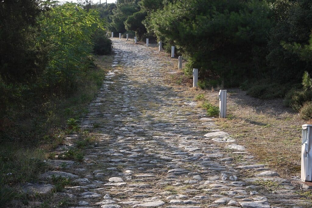
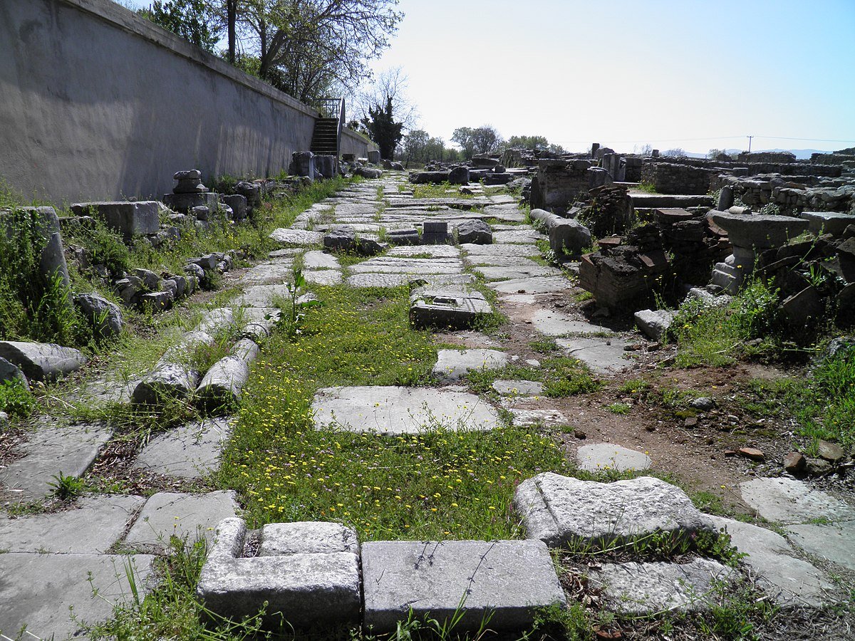
The main reason this network was so effective lay in Roman engineering expertise. The carefully constructed roads allowed carts, horses, and armies to travel even through rugged terrain. Roman roads were built in layers: heavy stones formed the base, followed by gravel, and topped with large, flat paving stones. The result was a durable surface capable of lasting for centuries. Many of these roads have survived in some form to this day, demonstrating the remarkable solidity and efficiency of Roman engineering.
Among the many regions that benefited from the network was Greece, a land with its own long history, rich culture, and established travel and transportation traditions.
Before the arrival of the Romans, Greece already had roads, but most were small, local routes connecting nearby towns or leading to various religious sanctuaries throughout the region. Travel was slow and often difficult, especially in the mountainous areas. Paths between cities did exist, but they were usually narrow, uneven, and unsuitable for heavy carts. These routes served the needs of the independent Greek city-states, but they were limited in scale and reach.
The sea remained the principal mode of transportation for the Greeks. The expansion of the Roman road network, however, fundamentally changed this reality.
When the Romans took over
To understand the impact of Roman roads, it is essential to recall what existed prior to their time. In Ancient Greece, people traveled mainly by sea, as the mountainous terrain made land routes challenging and slow. When the Romans arrived and Greece became part of a vast imperial system, the needs of the region changed dramatically. The Romans required faster and stronger roads to move their armies, collect taxes, and integrate Greece more closely into the Empire.
Yet, the Romans did not erase traditional Greek travel routes. They built upon them, upgrading and expanding existing roads to meet the Roman engineering standards seen throughout the Empire. The Roman approach to road building was highly systematic. Engineers carefully selected routes, leveled the ground, and used layered materials to create durable surfaces. Roads were slightly curved to allow rainwater to drain away, while bridges, drainage systems, and milestones added to their efficiency and precision.
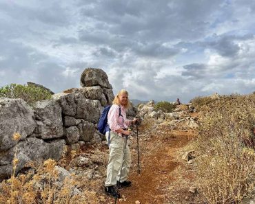
By ancient standards, this level of engineering was extraordinary. Many Roman roads remain visible today. In Greece, where earthquakes and steep terrain were common, Roman builders adapted their methods to local conditions, making travel safer and more accessible in regions that had once been difficult to reach.
Via Egnatia
One of the most vital Roman roads connected directly to the Greek world was the Via Egnatia. It served as a continuation of the Via Appia, one of the earliest and most strategically significant roads of the Roman Republic, which linked Rome to Brindisi. Stretching across the Balkan Peninsula from the Adriatic Sea to the Bosporus Strait and Byzantium, the Via Egnatia passed through regions now situated in Albania, North Macedonia, and Northern Greece. Once it entered Greek territory, it continued through major cities such as Thessaloniki, Philippi, and Amphipolis.
The Via Egnatia linked Greece and Italy via the Adriatic coast, and from the east it connected to routes leading deep into Asia Minor and eventually to the eastern provinces of the Roman Empire. This made Greece part of a major east–west corridor of the Mediterranean world. Along this route traveled goods, merchants, soldiers, officials, ideas, and religions, all contributing to the cultural and economic vitality of the region.
It was the first highway to traverse the entire Balkan Peninsula and also the first road built outside Italy by the Romans. Constructed between 146 and 120 BC by the Roman senator Gnaeus Egnatius, who named it after himself, the Via Egnatia reflected the growing importance of Macedonia as a Roman province. Egnatius became its governor shortly after Macedonia was conquered by Rome in 148 BC, following the Fourth Macedonian War.
A long highway
The Roman road stretched approximately 1,120 kilometers (696 mi.) and was about six meters wide although its easternmost sections may have been completed decades after Gnaeus Egnatius governed Macedonia. Parts of the Via Egnatia may have been built over an earlier military route connecting Illyria and Byzantium. The road linked several important cities across Northern Greece, Illyria, and Thrace, serving as a vital corridor for trade and the movement of Roman legions throughout the region.
At the westernmost end of the Via Egnatia lay Dyrrhachium in Illyria (modern-day Albania). Together with the nearby Greek polis of Apollonia, Dyrrhachium was a key commercial hub along the Adriatic coast. The road connected major urban centers such as Thessaloniki, Amphipolis, Philippi, Neapolis, Kypsela, and Pella—the birthplace of Alexander the Great and the former capital of the Kingdom of Macedon. At its eastern end stood Byzantium, which became even more significant after 330 AD, when Emperor Constantine renamed it Constantinople and pronounced it the capital of the Roman Empire.
The Via Egnatia was only one part of the broader Roman road system in Greece. Numerous smaller routes were built or improved to link cities, ports, and military bases. In the Peloponnese and Central Greece, roads connected Corinth, Argos, Sparta, Athens, and Thebes, strengthening communication and enabling smoother trade and administration across the region.
Corinth, already a strategic crossroads between northern and southern Greece, became even more important as a hub of land and sea travel. After the Romans destroyed the city in 146 BC, they later rebuilt it as a Roman colony, and the revived Corinth thrived—thanks in part to its easy access to the expanding Roman road network.

Roman roads and Greek trade
Trade, among other things, was profoundly transformed by the Roman road system. Prior to Roman rule, Greek trade relied heavily on ships sailing between islands and coastal cities. The sea remained central, but the development of durable land routes enabled goods to move faster and in multiple directions. Farmers could now transport grain, olives, oil, wine, and textiles to markets more efficiently. Craftsmen could send pottery, metalwork, and other products to distant buyers, while merchants from Greece traveled inland to sell their goods, and foreign traders visited Greek towns more frequently. This increased mobility stimulated economic growth and deepened Greece’s connections with neighboring provinces.
Another major effect of the Roman roads was the acceleration of cultural exchange. Greece had long been a center of art, philosophy, and science, and Rome deeply admired Greek culture. The improved network allowed Greek teachers, doctors, and artists to travel more easily throughout the Empire, spreading Greek thought and influencing Roman education and intellectual life. At the same time, Roman customs and architecture took root in Greece. Public buildings such as baths, amphitheaters, and forums began popping up in Greek cities, reflecting how travel and communication fostered a vibrant cultural blending between the two civilizations.
The movement of religions along Roman roads was especially significant. Greece played a key role in the early spread of Christianity. The Apostle Paul, for example, traveled along the Via Egnatia during his missionary journeys, preaching in cities such as Thessaloniki, Philippi, and Corinth, all of which were situated on or near major Roman routes. The roads allowed Christian communities to remain in contact through letters and visits, supporting the rapid growth of the new faith. Without the Roman road network, such journeys would have been slower, riskier, and far less predictable.
A defining feature of life
The presence of Roman roads also shaped military control and political unity. For an empire as vast as Rome, the ability to move soldiers quickly was essential. In Greece, as elsewhere, Roman troops could travel efficiently along the roads to suppress revolts, defend borders, or respond to threats. This military advantage helped maintain Roman authority in the region and brought a sense of stability that encouraged trade and settlement. Cities located along major roads often grew wealthier and more influential, with some gaining new administrative roles within the Roman provincial system.
Despite these benefits, the impact of Roman roads was not entirely positive for local populations. Road construction and maintenance sometimes required heavy labor or local contributions. Land was taken for public use, and Roman officials oversaw many aspects of travel. The roads also made it easier for Rome to extract resources from its provinces. While economic opportunities increased, so did taxation and administrative pressure. Still, for many people, the advantages of safer travel and improved communication outweighed the disadvantages.
Over time, the Roman road network became a defining feature of life in the Empire. In Greece, the roads were a visible sign of Roman presence, but they also functioned as tools that helped blend the Greek and Roman worlds. Even after the fall of the Western Roman Empire, many routes remained vital. The Byzantine Empire, centered in Constantinople, inherited much of the eastern road system, and Greece continued to serve as a crossroads between Europe and Asia. Although some roads were neglected or damaged in later centuries, parts of the old Roman paths continued to guide travelers, armies, and merchants.
Roman roads in the modern world
The influence of Roman roads is still visible today. Many modern highways follow the same routes as ancient roads, and the archaeological remains of Roman roads, bridges, and milestones can be found throughout Greece, demonstrating the advanced engineering of the Romans. The famous Via Egnatia continues to exist as a highway connecting the westernmost part of Greece, Igoumenitsa in Epirus, with the easternmost part, Kipoi in Evros, even though it runs parallel to the original route. More importantly, the principle of linking regions through reliable infrastructure remains a lasting legacy that continues to shape societies.
The Roman road network was one of the most remarkable achievements of ancient engineering and administration. In Greece, it transformed travel, trade, culture, and politics. Greek geography and traditions influenced how the roads were built and used, while Roman technology and imperial priorities reshaped the region. The result was a lasting impact that integrated Greece more closely into the broader Mediterranean world.